Talk about Indian mythology or Indian history and you will see the buzz around the famous Ram Setu bridge. The bridge is the shoal chain between India and Sri Lanka, and there has been a debate over whether the Ram Setu or Adam’s bridge is man-made or natural.
Before jumping to the question, let’s first get acquainted with the Ram Setu bridge a little more.

The Ram Setu Or The Adam’s Bridge
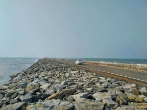
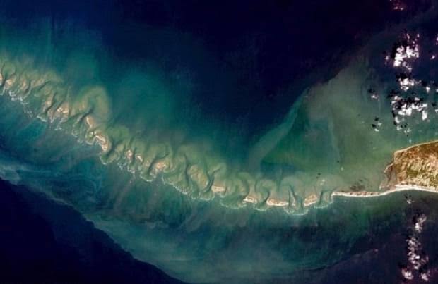
The Ram Setu Or The Adam’s Bridge is actually a chain of limestone shoals between Rameshwaram, India, and Mannar Island, Sri Lanka. The length of the limestone bridge is 48 km.
How Old Is The Ram Setu Bridge?
In a study titled ‘Project Rameswaram”, the Geological Survey of India stated that between 7,000 and 18,000 years ago, the islands of Rameswaram, India, and Talaimannar, Sri Lanka were exposed. If we include the dating or corals, it can be said that the Adam’s Bridge or the Ram Setu was formed around 500-600 years ago.
Why Is The Ram Setu Bridge Called “Adam’s Bridge?”
The famous Ram Setu bridge is called Adam’s Bridge for a specific reason, per a few early Islamic sources. According to the sources, there is a mountain in Sri Lanka known as Adam’s Peak. Supposedly, this is the region where biblical Adam first appeared on the planet. After the expulsion from the Garden of Eden, Adam crossed from Sri Lanka to India through this bridge. This led to the name, “Adam’s Bridge”.

Myth or real?
An American show claimed that Ram Setu or Adam’s Bridge is believed to be constructed by Lord Rama from the Indian epic the Ramayana. The bridge, as per the religious books, was built to rescue Sita (Rama’s wife) from Sri Lanka, where she was kept confined by Ravana. The man-made bridge is said to be built by Rama’s vanara sena (monkey army).
Here are some other interesting facts about Rama Setu:
1) If geologists and archaeologists are to be believed, the rocks of the bridge are over 7000-years-old, while the sandbar is about 4000-years-old. This implies that the rocks were brought here from some other place.
2) This ancient bridge is basically a chain of natural limestone shoals, connecting Rameswaram Island (also known as Pamban Island) in Tamil Nadu and Mannar Island in Sri Lanka.
3) It is said that the bridge was walkable until the 15th century. But then the storms deepened the channel and made it inaccessible. According to the Ramanathaswamy Temple records, the bridge was above sea level until a cyclone destroyed it in 1480.
4) The bridge also finds mention in the western world in Ibn Khordadbeh’s Book of Roads and Kingdoms, wherein the bridge is referred to as Set Bandhai or Bridge of the Sea.


