


Introduction
In mid‑September 2025, Dehradun in Uttarakhand was hit by a cloudburst event coupled with incessant rainfall and flash flooding. The disaster caused loss of life, damage to infrastructure, and left many communities cut off. More than just an isolated incident, the event highlights broader climate vulnerabilities in Himalayan foothills.
What Happened
- Timing & Intensity: Late on 15 September 2025, very heavy rainfall in a short span led to what many are calling a cloudburst in Dehradun.
- Official Definition & Debate: The India Meteorological Department (IMD) noted that rainfall rates were below some thresholds usually used to define a cloudburst (e.g. ~100 mm/hour) — Dehradun recorded ~67 mm/hour in some areas. While this may fall short of a strict definition, the damage was severe enough that many media reports still refer to it as a cloudburst.
- Affected Areas: Sahastradhara, Tapovan, Prem Nagar, Maldevta, Santla Devi, Karligad, Dalanwala and other nearby localities saw flash floods, landslides, road washouts, bridge collapses, inundated shops, and damaged homes.
- Casualties & Displacement: At least 13 people are confirmed dead in Dehradun, with others missing. Many were rescued; several are displaced.
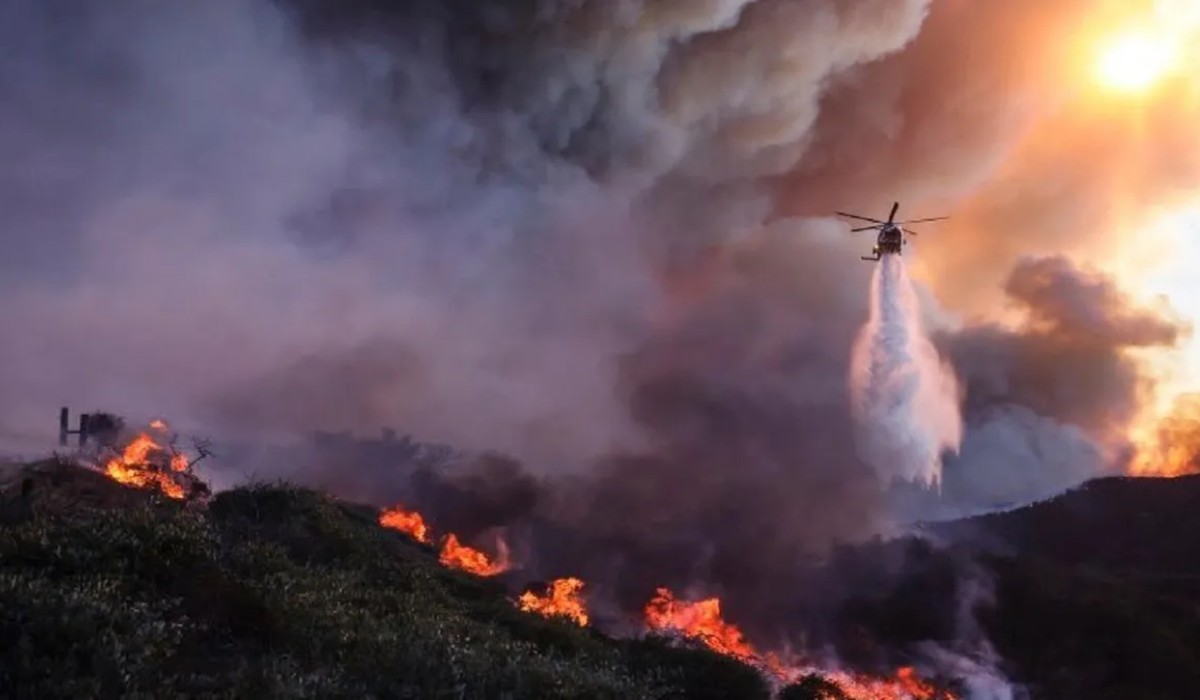
- Infrastructure Disruption: Bridges collapsed, roads were washed away, power and water supply disrupted in many parts. Critical routes including highway segments were rendered impassable. Despite rescue operations, reaching some areas is difficult.
- Alert & Response: A red alert was issued by IMD and district authorities. Schools (up to Class 12), anganwadis were closed. Disaster response teams (SDRF, NDRF etc.) mobilised.
Cloudburst in Dehradun: Causes & Contributing Factors
- Meteorological Causes:
- Intense moisture influx: Moisture‑laden easterly winds (from Bay of Bengal) interacting with westerly air masses.
- Unstable air masses and orographic lift: The hilly topography of Uttarakhand forces moist air upward, leading to rapid condensation and rainfall. Mountains trap the clouds, increasing the intensity.
- Exacerbating Factors:
- Urbanization & land use change: Construction (roads, bypasses, bridges), hill cutting, removal of vegetation in fragile zones (especially slopes) reduce the land’s ability to absorb rain, increase surface runoff.
- Deforestation / weaker natural drainage: Loss of tree cover and soil cover makes landslides more likely when heavy rains occur.
- Climate change: Warmer atmosphere holds more moisture; leading to more frequent and intense extreme precipitation events. These make such cloudbursts more common and more damaging.
Impacts
- Human Loss & Suffering: Deaths, missing persons, displacement of residents; distress and panic among communities, especially in remote/steep areas.
- Damage to Infrastructure: Collapsed bridges, washed away roads, shops and homes damaged, utilities impacted (electricity, water distribution) in many areas.
- Economic Disruption: Business affected (shops, hotels), travel disrupted, schools closed. Loss of tourism in hill regions. Cost to government and local bodies for relief, repair, rescue.
- Environmental Damage: Landslides, soil erosion, rivers overflow leading to sedimentation; destruction of flora; destabilisation of slopes.
What This Reveals About Rising Climate Risk
- Frequency & Severity of Extreme Rainfall Events are Rising
What may once have been rare severe rainfall episodes are happening more often. The combination of climate change and changing land use is shortening the intervals between major rainfall or cloudburst events. - Vulnerability of Himalayan / Foothill Regions
These regions are inherently fragile: steep slopes, unstable soils, numerous rivulets and rivers, frequent monsoon rains. Infrastructure and human settlements often lie in hazard‑prone zones. The current event shows how even relatively modest construction projects (if poorly planned) can amplify disaster risk. - Need for Better Urban Planning & Land Use Regulation
Unregulated hill cutting, improper drainage, encroachment of flood plains/rivers, inadequate assessment of slope stability, and poor adherence to building codes are making disasters worse. - Disaster Preparedness & Early Warning Systems are Crucial but Need Scaling Up
Alerts were issued, rescue operations deployed. But damage shows that warnings sometimes arrive after many risk factors are already in motion. Continuous monitoring, better forecasting at micro/local levels, swift action to evacuate & protect vulnerable populations can reduce casualties. - Adaptation and Resilience Investment are Not Optional
Investments needed in infrastructure that can withstand flash floods / heavy rains: robust bridges, better drainage / stormwater systems, slope stabilization, green cover restoration. Governments must factor climate risk into all development projects, especially in ecologically sensitive zones.
Also Read: GST 2.0 Explained: What Changes from September 22, 2025?
Challenges Ahead
- Data gap & definitions: What exactly counts as a “cloudburst” vs. “intense localized rainfall” is often ambiguous. Varying definitions and lack of hyper‑local observation stations hamper early warnings.
- Coordination across agencies: Multiple government departments — meteorology, disaster response, urban planning, environment — need to work seamlessly. Frequently, administrative and regulatory lapses (e.g. in permitting hill‑cutting, construction) contribute.
- Balancing development and ecological safety: Demand for roads, housing, tourist amenities in Uttarakhand is high. But rapid developmental push without adequate environmental safeguards increases risk.
Conclusion & Way Forward
Dehradun’s recent cloudburst and flood damage is a warning, not just a one‑off tragedy. It underlines the urgency of factoring climate risk into how we plan, build, and live—particularly in fragile mountainous regions. Key steps that emerge as priorities:
- Strengthen & enforce land use regulations and environmental clearance, especially for slopes, drainage, riverbanks.
- Expand early warning systems, improve meteorological stations at local level, improve real‑time monitoring of rivers and rainfall intensity.
- Invest in climate‑resilient infrastructure: slope stabilization, drainage, flood control, retaining walls, bridges built to withstand heavy flows, etc.
- Restore and protect natural vegetation, reforest fragile slopes, preserve watersheds to reduce runoff and erosion.
- Community awareness & preparedness: education, drills, simple risk mapping, local evacuation plans.
If climate change increases the intensity/frequency of such events — which most models predict — the human, economic, and ecological costs of not preparing will only escalate.
Also Read : Nitin Gadkari Major Warning After Operation Sindoor: ‘World War III Could Erupt Anytime